Western Mountains of Pakistan
1. Safed Koh Mountains - white mountains
- Average height 3600m
- Its highest peak is Mount Sikaram - 4,761 m
- The Kabul River cuts a channel in the north of the Safed Koh mountains to flow eastward into the Indus River. This narrow channel cuts it from the Hindukush Range.
- This range is located in the south of Hindukush Range.
- Kurram river passes from south of the Safed Koh Mountains.

Safed Koh Mountains
2. Waziristan Hills - altitude between 1,500 and 3,000 meters,
- Waziristan hills are located in the area west and southwest of Peshawar between the Kurram and Tochi River to the north and the Gomal River to the south.
- Bannu Valley lies in the east of these mountains.
- These mountains are rich in mineral deposits.
- These mountains are mostly barren.
- The Kurram River flows from the northwest to the southeast through Kurram Pass into North Waziristan and eventually joining the Indus River.
- Tochi River flows west to east through Tochi Pass.
- Gomal River flows west to east through Gomal Pass.
- The Gomal and Tochi Pass connect Pakistan to Afghanistan.
- the Gomal River forms the boundary between Balochistan and the South Waziristan Agency.
- Landforms in the area are varied and include piedmont, plains, valleys, gravel fans, rough broken land and gullied land.
 Waziristan Hills
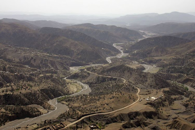 Gomal River Moving through Gomal Pass


